 |
Dave #2 and his "faithful dog Hobbes" |
Searching for the D&J #1 part 1
Dave #2 and I were each using our own dredges this year. Not partnering and sharing my dredge like last year. That meant that in the afternoon after working by ourselves all morning we were too tired to dredge any longer so we decided to see a little of the country around Downieville. Dave #2 was GPAA member and he wanted to check out their claim above Downieville. We pulled out his claim's guide and pored over the cryptic directions trying to decipher the accompanying map. Finally we loaded up Dave's truck with our camera equipment, a gold pan, Hobbes, Dave's dog, and then drove towards Downieville. Using map in the claims guide as a reference it looked like the road to the claim paralleled the Downie river. We turned off of hiway 49 on the upriver side of the bridge over the Downie River and drove past the housing along the river. After a short distance we were out of the town, (it didn't take long as Downieville has a population of 425), and heading up the mountain. The river quickly disappeared way down in the bottom of the canyon. Any sight of water was just a memory. The road just kept climbing and climbing winding among the huge trees. Finally after a few miles it dropped back down to a creek. After once again checking out the map in the claims guide we decided we were on the wrong road. We didn't want the trip to be a total loss so we took out a metal detector and walked over to an interesting bank to check it out. It might not be the right spot but "everyone" knows that you can find gold "anywhere" in California. No huge nuggets shredded the metal detectors headphones. I took a test pan of material and walked over to the creek and panned it out. Nothing. I tried several more and also found nothing. Since I wasn't finding any gold I decided to do the next best thing. I grabbed my camera and took some pictures!
|
Dave #2 and his "faithful dog Hobbes" |
As it was getting late in the afternoon we decided to give up for the day and return to our camp. We could hear the call of the cool ones in the ice chest awaiting our return.
The next afternoon, not being easily discouraged and also still being too tired to dredge any longer, we decided to try to find the claim one more time. This time we crossed the bridge over the Downie River and turned right at the stop sign onto Main Street. We were once again traveling up the river driving on the narrow street between the houses. After passing about 15 houses we were again out of the town. Driving a short way further we saw a sign. "Last chance to turn around. Road dead ends 500 yards". Not willing to believe the sign we drove on. For about 500 more yards and then the road dead ended in a locked gate. We had to back up to get turned around. Since the road wasn't on the other side of the river we had to be on the right side. We traveled a short distance back toward town and saw a road heading up the hill. We turned on it and once again headed out of town. The claims guide said that we needed to go a little more than 3 miles. No sweat. That wouldn't take long. That thought exposed us as the city folk that we were. 3 miles at about 5 miles an hour bouncing all over the front seat of the truck takes forever. We once again headed up the side of the mountain loosing all sight of the river way down the steep side of the mountain. I took this time to tell Dave to watch where he was driving. I would do all of the sightseeing for both of us. The road was slightly wider than Dave's truck. Every few hundred yards it would widen out a little so that 2 vehicles might be able to pass if both of them had one set of wheels hanging over the edge of the road. If you met anyone, somebody was going to have to back up for quite a ways before anyone could pass. As we traveled further and further, the road got even narrower and steeper. We had to drive through the water to cross several small streams. The road finally began to go back down hill and we were able to see the river once again. Still no claim markers though.
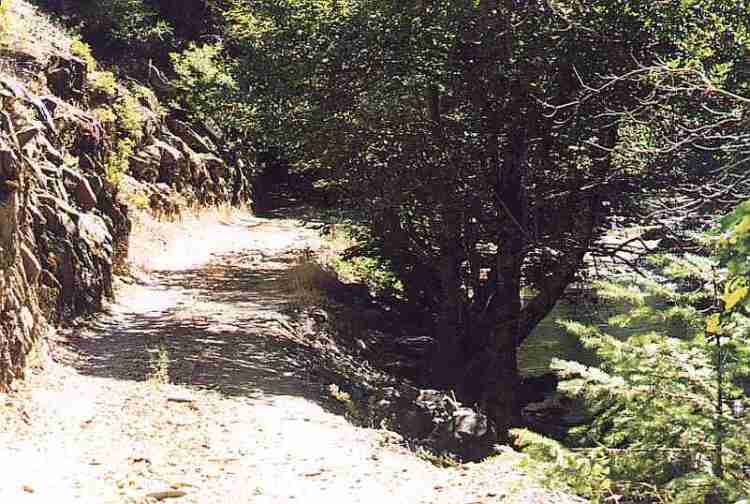 |
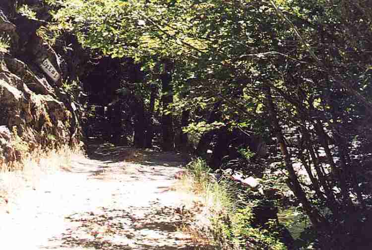
The "narrow section" of the road listed in the claims guide |
We traveled past several claims with camp sites and equipment scattered around. None of these were the correct one though. Finally we came to a exceptionally narrow section of the road. On one side the road dropped straight down about 15 feet into the river. On the other side a rock wall went straight up. This was the spot described in the claim's guide. Dave carefully maneuvered the truck through the narrow section. The mirror on his side was almost scraping the rock wall and I could look out my window almost straight down into the river. I wasn't getting out my side of the truck for anything. I couldn't without falling into the river below. After passing through the narrow section we saw the claim marker and we then pulled over into a parking spot. We had arrived.
 |
Notice the white claim sign in upper left of
the picture |
We were in the bottom of a small canyon alongside of a small stream. Both sides of the canyon went almost straight up. There was exposed bedrock everywhere. If this hadn't been worked to death, there had to be gold here. As hard as it was to find it might not have had a lot of pressure. The claims down stream indicated that there was gold there. It ought to be here also.